


Scaling New Heights: Mastering Mountaineering Navigation Skills!
Discover the secret techniques to conquer any peak with expert navigation skills - unleash the mountaineer within!

Embarking on a mountaineering adventure is an exhilarating experience that takes you to breathtaking heights. The sheer thrill of standing atop towering peaks, surrounded by awe-inspiring vistas, is unparalleled. However, amidst the excitement, it is essential to ensure your safety and successfully navigate the rugged terrain. That's where mastering essential navigation and map-reading skills comes into play! In this curated blog post, we will uncover the crucial techniques that every mountaineer should master to optimize their adventure while minimizing risks.
Understanding the Importance of Navigation Skills
Imagine finding yourself lost in the vast wilderness, unsure of which direction to take. The gravity of the situation quickly becomes apparent. Navigational proficiency is vital in mountaineering. It not only ensures your safety but also aids in route planning and enables you to make well-informed decisions in challenging terrains.
Let me tell you a story... Once upon a time, there was a brave mountaineer named Emily who embarked on a challenging expedition. She was exhilarated as she started her ascent, unaware of the risks that lay ahead. However, lacking adequate navigation skills, she soon found herself disoriented, facing a fork in the path, with no idea which way to turn. It was a terrifying moment that could have been avoided with essential map-reading techniques.
That's why it's crucial to improve your navigation skills. The good news is anyone can become adept at navigation with practice. So, let's dive into the world of mountaineering navigation!
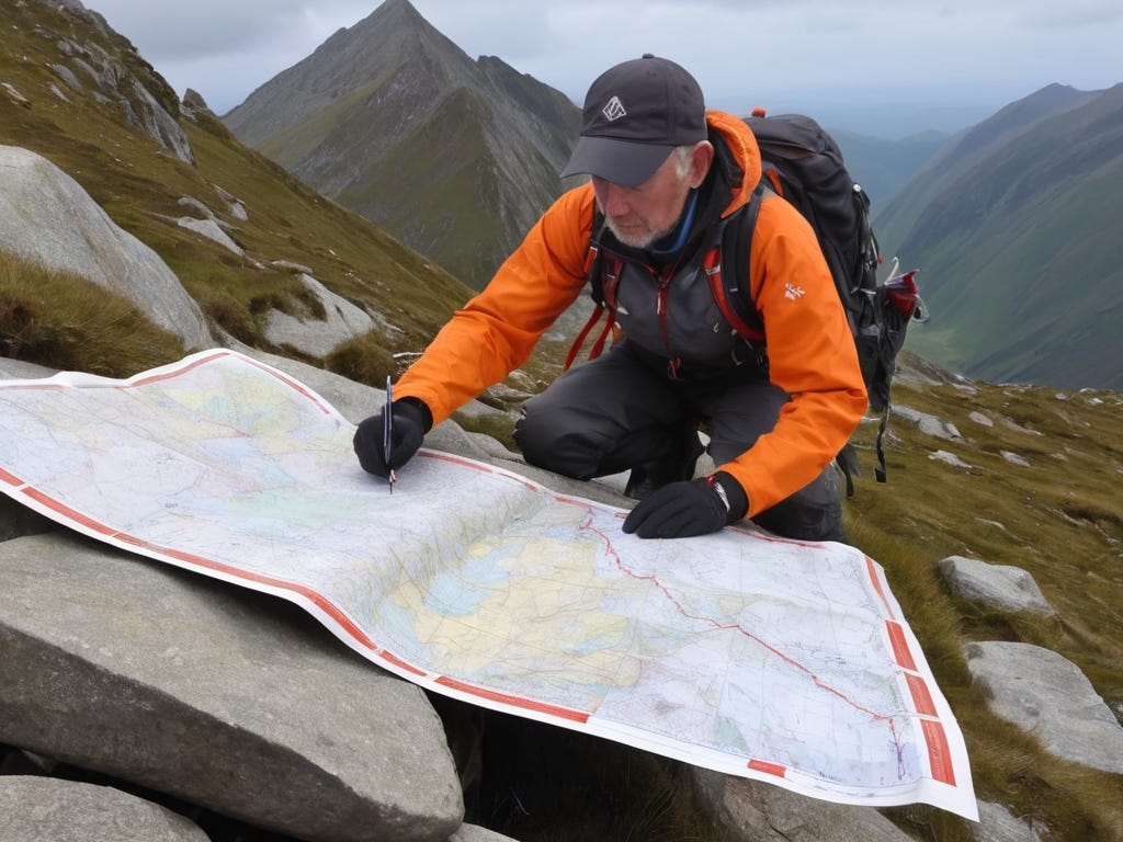
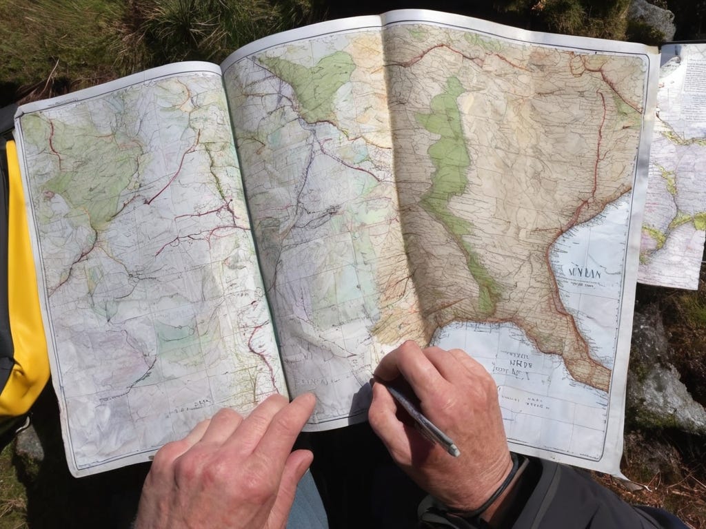
Topographic Maps: The Mountaineer's Best Friend
When it comes to mountaineering, topographic maps are an indispensable tool in your arsenal. These detailed maps are specifically designed to showcase the contours and features of a region and provide essential information for navigation.
So, what do those squiggly lines mean on these maps? Well, those are contour lines! Contour lines indicate elevation changes, helping you identify steep slopes, valleys, and peaks. By understanding how these lines connect, you can better visualize the terrain and plan your route accordingly.
But that's not all! Topographic maps also use symbols to represent various features, such as rivers, lakes, forests, and important landmarks. Understanding these symbols is key to deciphering the map accurately. For example, a small blue squiggle represents a river, while a brown shaded area signifies a dense forest. Paying attention to these symbols ensures you don't mistake a steep cliff for a gentle slope.
Another important aspect of topographic maps is scale and distance measurement. These maps typically indicate scale ratios, allowing you to estimate real-world distances accurately. By measuring distances on the map and using the scale, you can gauge travel times, plan rest stops, and ensure you stay on schedule during your mountaineering adventure.
Now, imagine being able to combine your topographic map with other relevant information. Transparent map overlays can be used to incorporate weather forecasts, avalanche reports, or other crucial data. This integration enables you to make more informed decisions, increasing your safety and improving your overall mountaineering experience.
Compass Navigation: A Mountaineer's Trusted Guide
A compass is a mountaineer's trusted guide, an essential tool for navigation in the great outdoors. It helps you find your direction, maintain a bearing, and navigate through challenging terrains.
But let's start with the basics - cardinal directions and orienteering. Cardinal directions, namely north, south, east, and west, form the foundation of navigating with a compass. By identifying these directions accurately, you can align your map with the compass and ensure you're heading in the right direction.
One powerful technique in compass navigation is triangulation. By picking distinct landmarks on your map and using your compass, you can triangulate your location. This method helps you pinpoint where you are on the map, allowing for precise navigation to your desired destination.
Next, let's talk about declination adjustments - a crucial aspect of compass navigation. Magnetic declination refers to the difference between true north and magnetic north. Not accounting for this difference could lead you in the wrong direction. Adjusting your compass accordingly ensures you stay on the right path and prevents any unwanted detours.
Mountaineering is an adventure filled with uncertainties, and unforeseen circumstances can arise. That's why it's important not only to navigate in ideal conditions but also to prepare for emergencies. Low visibility, dense fog, or lack of prominent landmarks can make navigation tricky. This is where your compass becomes your lifeline, guiding you through any challenges you might face.

Conclusion
As you stand atop a majestic peak, gazing out at the sprawling landscapes below, you realize the magnitude of your accomplishment. Mastering navigation and map-reading skills has allowed you to conquer incredible mountaineering adventures with confidence.
Remember, navigation skills are not only crucial for your safety but also enhance your overall experience in the mountains. Whether it's understanding topographic maps, interpreting contour lines, or using a compass effectively, each of these skills brings you closer to becoming a seasoned mountaineer.
So, continue practicing, honing your skills, and exploring new heights. There are countless resources, books, and courses available to aid your journey. With dedication and perseverance, you can unlock a world of possibilities and conquer the mountains with confidence!